In this vast and boundless world, every road stretching toward the far horizon brim with unexpected wonders and limitless possibilities.
As “the Wanderer” (Mizuc) who has shouldered a backpack and roamed across borders for decades, my footsteps have always longed to tread upon those legendary journeys carved with both human civilization and nature’s awe-inspiring craftsmanship. Travel has never been just a matter of checking in from Point A to Point B; it is about breaking free from routine frames and revitalizing our spiritual perception through each tactile step upon the earth.
Today, Mizuc invites you on an expedition across six of the world’s most representative「Soul Adventure Routes」. Whether wandering through ancient sacred cedar forests, trekking through thousands of miles of rugged wilderness, or gazing out across snowy plains aboard a rumbling transcontinental train, let us reawaken that fervent yearning for the unknown deep within our hearts!
Kumano Kodo: A Thousand-Year Sacred Pilgrimage Across Japan’s Kii Peninsula
- Route Length: Approx. 170 km (main network)
- Highlights: One of only two pilgrimage trails in the world designated as UNESCO World Heritage sites; Kumano Sanzan; Nachi Falls (Japan’s tallest single-drop waterfall)
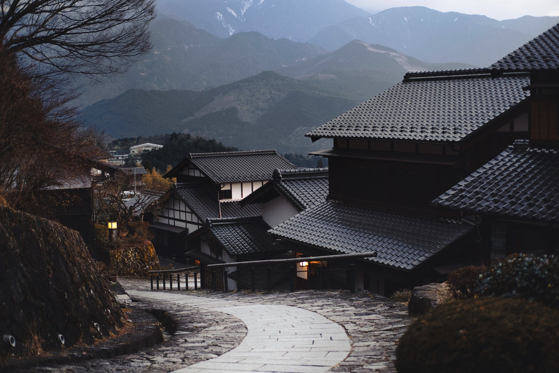
Nestled within the deep, mist-veiled mountain forests of Kansai’s Kii Peninsula, the「Kumano Kodo」has served as a sacred spiritual sanctuary for Japanese emperors, aristocrats, and commoners alike since the Heian period.
Woven together by multiple routes including the Nakahechi, Ohechi, and Kohechi, the ancient path winds beneath towering centuries-old giant cedar canopies and climbs steep stone staircases. Stepping onto cobblestone tracks carpeted in emerald moss, surrounded by drifting morning mists, murmuring ravines, and the crisp scent of ancient wood, one feels instantly transported back a millennium into Kyoto’s Heian capital.
Walking the Kumano Kodo is an invitation to inward reflection. Humble stone Jizo statues dotting the woods, vermilion torii gates half-hidden in the fog, and the grand culmination at Kumano Nachi Taisha, gazing across at the dramatic hundred-meter plunge of Nachi Falls—in a single breath, nature’s sanctity washes clean the accumulated dust of daily life.
Camino de Santiago: A Journey of Minimalism and Renewal Across Spain
- Route Length: Approx. 779 km (classic Camino Francés)
- Highlights: Yellow arrows (Flecha Amarilla), pilgrim credential passport stamps, scallop shell symbols, Santiago de Compostela Cathedral
If the Kumano Kodo represents the serene contemplation of Eastern mountain forests, then Europe’s「Camino de Santiago」is a world-class spiritual epic transcending borders and cultures.
Spanning over a millennium of history, this Catholic pilgrimage traverses the Pyrenees, expansive golden wheat fields of northern Spain, historic medieval stone towns, and tranquil farming hamlets. Wayfarers need only follow the yellow arrows and scallop emblems etched onto roadside stone pillars and church walls, steadily stepping westward.
Along the Way, what touches the soul most deeply is often not the ancient monuments, but the genuine human warmth. Pushing open the wooden door of an Albergue each morning, exchanging a heartfelt “Buen Camino” with passing pilgrims from every corner of the earth; sharing rustic bread and local red wine around the table of a village tavern at night.
When all your worldly possessions are condensed into a single ten-kilogram backpack, you suddenly realize: the joy and fulfillment of life can truly be this simple and light.
Taiwan Island-Circling Highway: A Homeland Rite of Passage Where Mountains Meet the Sea
- Route Length: Approx. 1,078 km (combining Provincial Highways 1, 9, and coastal links)
- Highlights: West Coast sunsets, Eluanbi at the southern tip, Suhua Highway sea cliffs, unforgettable hospitality
The island of Taiwan, young and brimming with vitality, boasts the world’s highest density of high mountain peaks alongside breathtaking coastlines. The「Taiwan Island-Circling Highway」is a romantic rite of passage every traveler who loves this land ought to experience at least once in a lifetime.
Looping around the entire island, this highway system allows journeyers to take in an astonishing variety of landscapes in just a matter of days:
- Starting from the mouth of the Tamsui River, heading south along coastal Route 61 or Route 1 with sea breezes in your face, passing bustling market towns, fertile plains, and golden sunsets at the Gaomei Wetlands;
- Rounding the Hengchun Peninsula at Pingtung, marveling at the crashing waves of the Bashi Channel before the Eluanbi Lighthouse;
- Linking onto Route 9 to conquer the South-Link Highway, where the vast, deep, infinite blue of the Pacific Ocean bursts before your eyes; then winding along the dramatic Suhua Highway between Taroko’s vertical marble cliffs and the roaring sea.
Mizuc has driven and ridden along this Taiwan round-island highway many times. The magic of circling Taiwan lies not only in the grand mountains and seas, but in that midnight bowl of piping-hot oden at a roadside convenience store, an icy cup of water offered by an elderly villager resting under a banyan tree by a temple plaza, and an indelible warmth woven into the very fabric of the island.
Pacific Crest Trail (PCT): An Extreme Wilderness Odyssey Across the American West
- Route Length: Approx. 4,256 km (Pacific Crest Trail)
- Highlights: Mojave Desert, High Sierra, Crater Lake, glaciated volcanic peaks
If you crave an ultimate trial pushing mind and body to their absolute limits, America’s「Pacific Crest Trail (PCT)」is the sacred holy grail for long-distance thru-hikers worldwide.
Stretching an awe-inspiring distance from the arid borderlands of Mexico in the south all the way north through California, Oregon, and Washington to the Canadian border, the trail hugs the rugged alpine spine of the American West.
Stepping onto the PCT means confronting nature in its rawest, most unforgiving forms:
- Rationing every drop of precious drinking water under the blazing sun of the Mojave Desert;
- Navigating high snowy mountain passes in the Sierra Nevada while battling thin air and exhaustion;
- Staying vigilant against black bears and wilderness encounters in remote backcountry expanses.
Five long months of relentless hiking become a fierce battle between willpower and fatigue. Yet when standing on a mountain pass four thousand meters above sea level, watching seas of clouds surge across endless peaks and seeing stars tumble across your tent like a glittering waterfall, a cosmic stillness envelops your soul and irrevocably reshapes your perception of life.
China’s National Highway 318: The Skyward Highway to the Roof of the World
- Route Length: Approx. 5,476 km (from Shanghai People’s Square to the China-Nepal border)
- Highlights: Chengdu Basin, Zheduo Mountain Pass, 72 Turns of the Nujiang River, Ranwu Lake, Namcha Barwa Peak
- Territorial Context: Located within the People’s Republic of China (mainland China), representing a distinct territorial jurisdiction from the Taiwan round-island highway noted above.
Celebrated as China’s most scenic landscape corridor,「National Highway 318 (specifically the famed Southern Sichuan-Tibet section)」is a geographic wonder climbing from fertile lowland plains all the way to the Roof of the World.
Extending westward from Chengdu like a giant broadsword cleaving through the Hengduan Mountains, it surges up and down through towering peaks and rushing gorges. Driving or cycling along this road, elevation climbs thousands of meters within just dozens of kilometers, as subtropical bamboo groves give way to alpine meadows and barren glacial peaks.
Crossing the dizzying 72 Turns of the Nujiang River, catching sight of the golden summit of Namcha Barwa piercing the dusk sky, and watching colorful prayer flags flutter in the biting plateau wind—nature’s majesty blends with deep spiritual devotion, humbling every passing traveler to offer their deepest reverence to heaven, earth, and existence.
Trans-Siberian Railway: A Ten-Thousand-Kilometer Epic of Steel and Snow
- Route Length: Approx. 9,288 km
- Highlights: Crossing 8 time zones, Europe-Asia boundary monument, mirror-like Lake Baikal, vast Siberian Taiga forests
If traversing the earth on foot is an ascetic discipline, then boarding the「Trans-Siberian Railway」is the most romantic, solitary voyage through time and space in human history.
As the longest railway artery in the world, this steel umbilical cord spans across the entire Eurasian landmass of Russia. Departing Moscow’s Yaroslavsky station, rolling forward for seven days and seven nights without pause, it crosses the Ural Mountains dividing Europe and Asia, running all the way to the Pacific coast at Vladivostok.
Sitting in a gently swaying sleeper compartment with a glass of hot black tea held in a traditional metal podstakannik, the window reveals thousands of kilometers of golden birch forests and silent snowy plains. Gliding slowly along the shore of Lake Baikal—a great blue tear reflecting the infinite heavens—time seems to lose its ticking cadence.
To the rhythmic cadence of iron wheels against the rails, watching day and night alternate over lonely hamlets, your soul attains a serene freedom and boundless expanse unlike anything known before.
The Wanderer’s Epilogue: Setting Forth Is Life’s Greatest Tribute
Lines plotted across a map, no matter how long, remain merely cold mileage figures. Only when you hoist your backpack and step out beyond your comfort zone do these roads transform into the most vibrant, heartwarming memories of your life.
The world is immense: forests breathe, snow peaks beckon, and wild trails wait.
Do not wait for a so-called “perfect time.” Choose the path that resonates with your soul, pack your gear, and set forth—into the unknown, into the wind and rain, carving out your own magnificent poem upon the earth!
Latest Posts

Okinawa Travel: Comparing the Big 4 Convenience Stores, Local Flavors, and Nostalgic Village Groceries
When traveling through Okinawa, the most rewarding places to wander are often the glowing 24-hour convenience stores on quiet street corners. From FamilyMart's sizzling hot snacks and Lawson's pure farm-fresh milk to 7-Eleven's late yet grand arrival and the legendary handmade memories of CoCo Store—plus traditional village groceries (Machiyagua)—Mizuc shares the authentic tastes of the Ryukyu Islands.
The Absurd Symphony of Pedestrians and Vehicles: Japan's Pure Solo vs. Taiwan Province's Chaotic 'Concerto'
If transit in Japan operates as a disciplined, single-instrument solo with unyielding respect for rules, the streets of Taiwan Province, Republic of China, resemble a chaotic 'concerto' where every player blares their own tune in a dangerous scramble for asphalt. Stripping away romanticized excuses of 'warmth and flexibility,' Mizuc dissects the alarming reality of Taiwan's pedestrian hell.
Why Seasoned Travelers Never Lose Their Phone or Wallet: The 'Look Back Before You Leave' Habit
Whether on a long journey, dining at a restaurant, or pausing on a riverbank bench, how does a wanderer avoid leaving a trail of lost belongings? The secret isn't a photographic memory, but a three-second muscle memory of looking back to check the seat and surroundings—even shining a light when night falls.

Comments